Why Is Mangrove Data Important?
Mangrove village Bakau Aceh Mandah District Indragiri Hilir regency is a coastal area whose community life is very dependent on the existence of mangrove ecosystems. Mangrove forests act as natural coastal protection, habitat for various aquatic biota, as well as the main support for community fishing activities.
Although its role is very important, but before 2025 the condition of mangrove ecosystems in Bakau Aceh villages has not been systematically documented. Information on the distribution, extent, density, and composition of mangrove species is still very limited. This lack of baseline data makes it difficult for villages to formulate policies, determine protection priorities, and plan for sustainable mangrove management. Therefore, mangrove data is a key cornerstone in ensuring that every management decision is based on real ecological conditions.
Activity approach: combining Maps and field Data
This survey activity is designed to generate spatial data and complementary field data. Mangrove distribution maps were created using village administrative boundaries from the Geospatial Information Agency (BIG), Sentinel-2A satellite imagery with a resolution of 10 meters, and the 2023 National Mangrove map from the Ministry of Environment and Forestry (MoEF). This map is used as a basis for understanding mangrove distribution patterns and determining sampling locations.
Mangrove density measurement was done by plot sampling method as many as 15 plots measuring 10 × 10 meters. Each individual mangrove in the plot is identified up to its type level and the number of individuals is counted. This approach allows the reading of mangrove conditions not only visually through maps, but also quantitatively through field data.
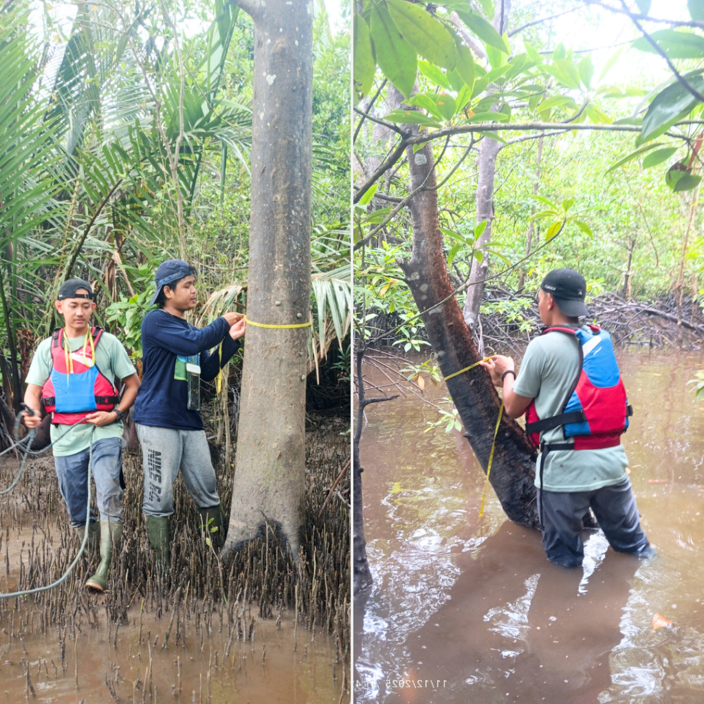
Picture 1. Measurement of the diameter of the trunk at chest level (DBH) mangrove as part of a vegetation survey to determine the density and structure of the stand in the village of Bakau Aceh.
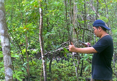
picture 2. The process of recording data on the type and number of individual mangroves in the plot
This program supported by OCEAN (Ocean Community Empowerment and Nature Programme), funded by UK International Development in 2024-2027. Involving four teams consisting of Mitra Insani Foundation staff accompanied by the chairman of the Village Forest Management Institute (LPHD) Bakau Aceh, as well as three internship students majoring in Forestry, University of Riau, one of whom is a woman.
What was found in the field?
Spatial distribution of mangroves
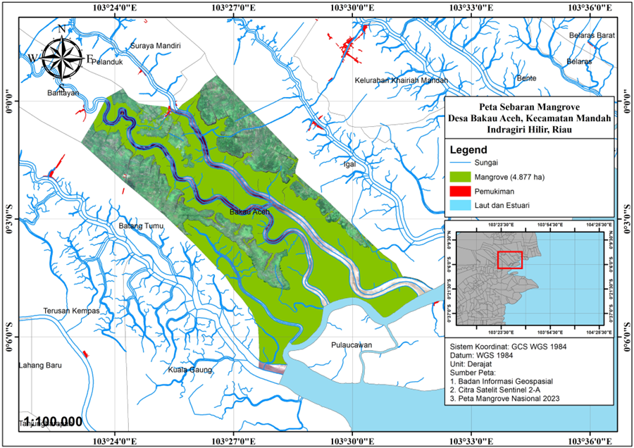
picture 3. Mangrove Distribution Map of Bakau Aceh Village, Mandah District, Indragiri Hilir Regency, Riau.
Map analysis results show that mangroves in Bakau Aceh Village, are concentrated in the southern part of the village. The mangrove area in Bakau Aceh Village, covers 1,036 hectares, forming a coastal mangrove belt that follows the coastline and tidal river channels. This pattern confirms that hydrological conditions remain a major factor supporting the presence of mangroves in the area.
Mangrove Density and Species Composition
The results of a survey of mangrove vegetation in Bakau Aceh Village, indicate that the mangrove ecosystem remains in relatively good condition, in terms of density and species diversity. A total of 547 mangrove individuals were recorded, with a total density of 2,735 individuals/ha, according to the FAO, UNEP, and Bengen mangrove density criteria. This value falls into the high density (dense) category. The number of individuals per hectare is shown in Table 1.
Table 1. Density and composition of mangrove species.
| No | Type | Number of Individuals | density (ind/ha) |
| 1 | Xylocarpus granatum | 232 | 1.160 |
| 2 | Rhizophora apiculata | 161 | 805 |
| 3 | Bruguiera parviflora | 50 | 250 |
| 4 | Bruguiera gymnorrhiza | 32 | 160 |
| 5 | Bruguiera sexangula | 20 | 100 |
| 6 | Rhizophora mucronata | 19 | 95 |
| 7 | Sonneratia ovata | 10 | 50 |
| 8 | Lumnitzera littorea | 10 | 50 |
| 9 | Nypa fruticans | 8 | 40 |
| 10 | Scyphiphora hydrophyllacea | 4 | 20 |
| 11 | Avicennia alba | 1 | 5 |
| Total | 547 | 2.735 |
picture 4. Percentage of the number of individuals and density of mangroves based on species in Bakau Bakau Village.
The mangrove species composition shows that X. granatum (Nyirih) is the most dominant species, with 232 individuals and a density of 1,160 individuals/ha, or approximately 42% of the total mangrove density. This dominance is clearly illustrated in the pie chart (Figure 4), which shows the largest contribution of X. granatum compared to other species. The presence of this species indicates that some of the mangrove areas in Bakau Aceh Village are in relatively stable substrate conditions and have developed into a more mature stand phase.
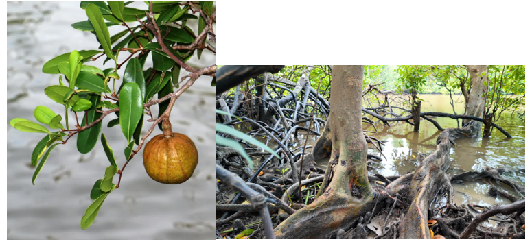
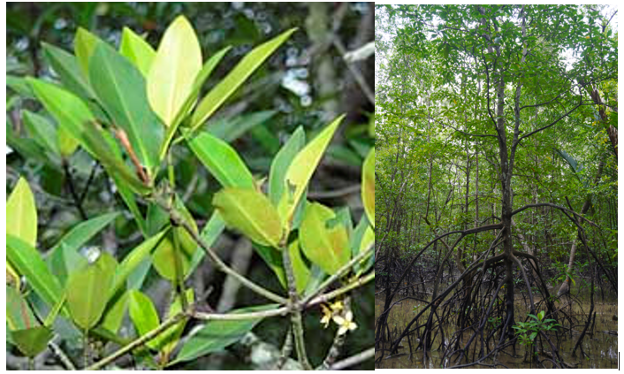
picture 5. Xylocarpus granatum (nyirih), the dominant mangrove species in Bakau Aceh Village, indicates that the ecosystem is relatively stable and has developed well.
R. apiculata (mangrove) ranks second with a density of 805 individuals/ha (161 individuals). R. apiculata remains crucial, particularly in strengthening the structure of mangrove ecosystems in areas still affected by tidal dynamics. The prop roots of this species serve as sediment retainers and natural protection against abrasion and waves.
picture 6. R. apiculata mangrove has stilt roots which play an important role in retaining sediment and protecting the coast from abrasion and waves.
The Bruguiera group (Bruguiera parviflora, B. gymnorrhiza, and B. sexangula) also contributes to the stand structure, although at lower densities than the two main dominant species. The presence of several Bruguiera species reflects the relatively heterogeneous ecosystem conditions and supports the diversity of mangrove vegetation structures.
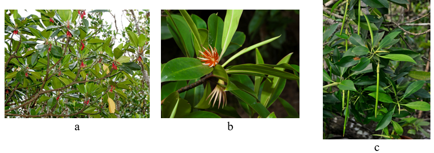
picture 7. (a) Bruguiera gymnorhiza (tumu), (b) Bruguiera sexangula, (c) Bruguiera parviflora (lenggadai).
Other mangrove species such as S. ovata, L. littorea, N. fruticans, S. hydrophyllacea, and A. alba were recorded at low densities. A. alba was only found at 1 individual (5 individuals/ha), so it did not play a significant role in the density of the stand structure. However, the presence of these low-density species remains important as indicators of species diversity and demonstrates that the mangrove ecosystem in Bakau Aceh Village is still able to support various mangrove species with varying ecological needs.
From Data to Action: Implications for Mangrove Management
The integration of mangrove distribution maps and vegetation density data provides a comprehensive picture of the condition of the mangrove ecosystem in Bakau Aceh Village. The dominance of X. granatum and R. apiculata, along with the high total density, indicates that most mangrove areas still serve a strong ecological function as coastal protection, abrasion barriers, and habitats for aquatic biota.
Mangrove zones with high density and diverse species composition should be prioritized as protected areas. These areas have the potential to serve as sources of natural propagules and play a crucial role in maintaining the sustainability of the mangrove ecosystem as a whole. Protection efforts should focus on preventing land clearing, illegal logging, and other activities that can reduce vegetation density.
Meanwhile, species with low densities can form the basis for selective mangrove rehabilitation planning based on natural zoning. Rehabilitation should not be carried out uniformly, but rather tailored to hydrological conditions and habitat characteristics, so as not to disrupt the well-established natural structure of the mangroves. Thus, mangrove density data not only serves as information on current conditions but also serves as the primary basis for developing village policies, rehabilitation planning, and establishing sustainable mangrove management zones.
Lessons Learned and Next Steps
The involvement of women in technical field activities demonstrates that the natural resource management process is not exclusive, but open and inclusive for various groups. This approach not only strengthens local capacity but also encourages the regeneration of mangrove management actors at the grassroots level. The application of GEDSI principles in this activity provides an important lesson that ecological data collection and community-based mangrove management can go hand in hand with the values of social justice and inclusivity, ultimately strengthening the sustainability of coastal conservation programs.
The mangrove survey in Bakau Aceh Village provided several important lessons, both technically and institutionally. From a technical perspective, the use of the plot sampling method proved effective in quantitatively describing the density and composition of mangrove species. The resulting data were able to objectively identify dominant species, stand structure, and the health of the mangrove ecosystem.
This activity also emphasized the importance of survey planning that takes tidal conditions into account and coordinates field teams. Collaboration between Mitra Insani Foundation staff, student volunteers, and the village government enabled the project to run effectively and strengthen local capacity in collecting mangrove ecosystem data.
The survey data will be used as a baseline in developing the Mangrove Ecosystem Profile for Bakau Aceh Village, supporting the formulation of Mangrove and Fisheries Village Regulations, and as a basis for planning the Social Forestry Work Plan (RKPS) for the Bakau Aceh Village Forest Management Institution (LDPH).
Conclusion
Through a data-driven, participatory, and inclusive approach, this survey is an important first step in ensuring the sustainable management of Bakau Aceh Village’s mangroves. Mitra Insani Foundation is committed to continuing to support coastal ecosystem protection and restoration efforts as a tangible contribution to environmental resilience and the well-being of coastal communities.
By: Hendri Susilo Program Officer Mangrove, Mitra Insani Foundation


